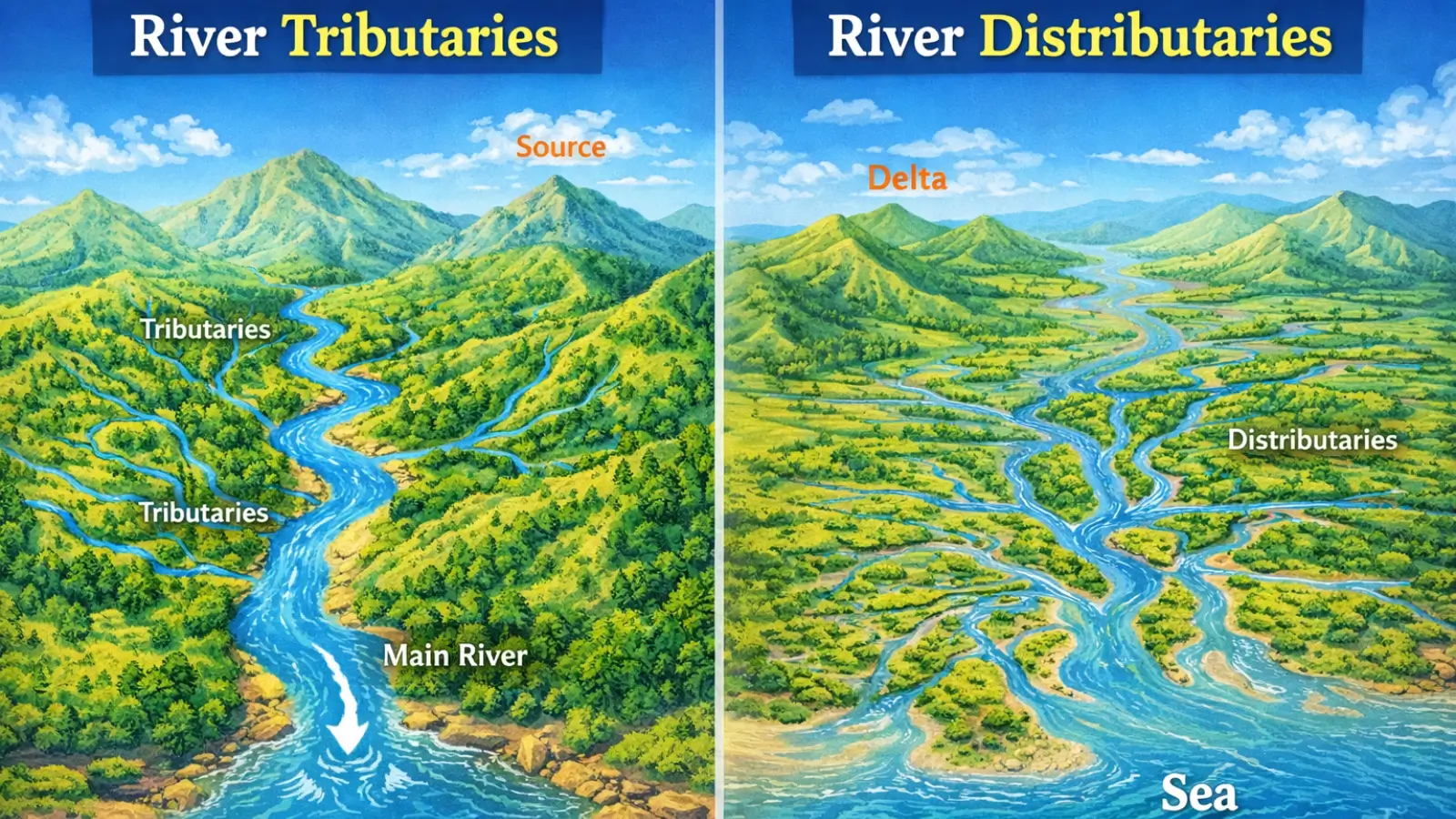
River Tributaries
A river tributary is a river or stream that joins a larger river, contributing additional water, sediment, and energy to the main channel. The point at which a tributary meets the main river is known as a confluence. Tributaries are fundamental to the growth and sustenance of a river system, as they expand the drainage area and increase the discharge of the main river downstream.
From a hydrological standpoint, river tributaries act as collectors of runoff from different parts of the river basin. Rainfall, snowmelt, and groundwater from diverse sub-regions are channelised through tributaries before reaching the trunk stream. As a result, the flow regime of a major river reflects not only conditions near its source but also climatic and environmental variations across its tributary catchments.
Geomorphologically, river tributaries play an important role in shaping river valleys. In the upper and middle courses, tributary erosion contributes to valley widening and deepening. The relative size and gradient of tributaries influence the pattern of confluences and the overall drainage texture of a basin. Where tributaries join a river at significant height differences, features such as hanging valleys and waterfalls may develop.
Classification of River Tributaries
Tributaries can be classified on several bases. On the basis of their origin, they may be
- snow-fed,
- rain-fed, or
- spring-fed.
Based on their structural relationship with the main river, tributaries may be
- consequent,
- subsequent,
- resequent, or
- obsequent.
From a spatial perspective, they may be described as
- left-bank or
- right-bank tributaries,
depending on the side from which they join the main river when facing downstream—a distinction often tested in competitive examinations.
In the Indian context, major tributaries such as the Yamuna, Ghaghara, and Kosi significantly influence the discharge, sediment load, and flood behaviour of the Ganga. The study of tributaries is therefore essential for understanding flood dynamics, inter-state water sharing, and river basin management.
River Distributaries
In contrast to tributaries, a distributary is a channel that diverges from the main river and flows away from it, usually in the lower course. Distributaries are most commonly associated with deltaic environments, where a river loses velocity upon entering a standing body of water and deposits large quantities of sediment.
Distributaries form as the river attempts to maintain its gradient by splitting into multiple channels. Sediment deposition raises the river bed, forcing water to seek alternative paths of flow. Over time, this process creates a network of branching channels that distribute water and sediments across a wide area.
From a geomorphological perspective, distributaries are agents of land building. They play a crucial role in the formation and expansion of deltas, floodplains, and coastal plains. The sediments carried and deposited by distributaries contribute to soil fertility, making deltaic regions among the most productive agricultural zones in the world.
Hydrologically, distributaries reduce the energy of the main river by spreading its flow over multiple channels. However, they can also create complex flow conditions, including channel shifting and avulsion. In regions with strong tidal influence, some distributaries may experience bidirectional flow, especially near their mouths.
In India, the Ganga–Brahmaputra delta exhibits a dense network of distributaries, such as the Hooghly. These channels have historical significance, as they influenced settlement patterns, trade routes, and port development. At the same time, distributary regions are often vulnerable to flooding, erosion, and salinity intrusion.
Distinction Between River Tributaries and Distributaries
Although both tributaries and distributaries are secondary channels connected to a main river, they differ fundamentally in their direction of flow, location along the river course, and geomorphic function. Tributaries generally occur in the upper and middle courses and contribute to river growth through addition of water and sediment. Distributaries, by contrast, occur mainly in the lower course and represent a dispersal mechanism that facilitates sediment deposition and delta formation.
This distinction is not merely terminological but reflects different stages of river evolution and contrasting fluvial processes. Understanding this difference is essential for interpreting drainage maps, analysing river behaviour, and answering conceptual and application-based questions in competitive examinations.
| Basis of Distinction | Tributaries | Distributaries |
|---|---|---|
| Meaning | Smaller streams or rivers that join a main river | Branches that flow away from the main river |
| Direction of Flow | Flow towards the main river | Flow away from the main river |
| Stage of River Course | Upper and middle course | Lower course |
| Number | Generally many | Comparatively fewer |
| Role | Increase water volume of the main river | Distribute river water over a wider area |
| Associated Landforms | River valleys and drainage basins | Deltas and alluvial plains |
| Examples (India) | Yamuna, Alaknanda | Hooghly, Godavari distributaries |
Must Read Articles Associated with this Topic
This article is part of a series of articles that clear basic concepts of the drainage system and the river system. Students and aspirants are also advised to refer to the articles mentioned below.
- Drainage System & River System
- River Source & River Mouth
- Three Stages of River
- Three Processes of Rivers — Erosion, Transportation, and Deposition
- River Basin, Catchment Area, and Watershed
- River Tributaries & River Distributaries
- Drainage Patterns & Structural Control
- River Rejuvenation and Associated Fluvial Landforms
NCERT Geography Books and Other Sources
Students and aspirants are also advised to refer to the sources mentioned below.
- NCERT Geography Book of Class 9, Chapter 3: Drainage
- NCERT Geography Book of Class 11, Chapter 3: Drainage System
- Article on Major River System in India created by India- Water Resource Information System (WRIS) by Ministry of Jal Shakti