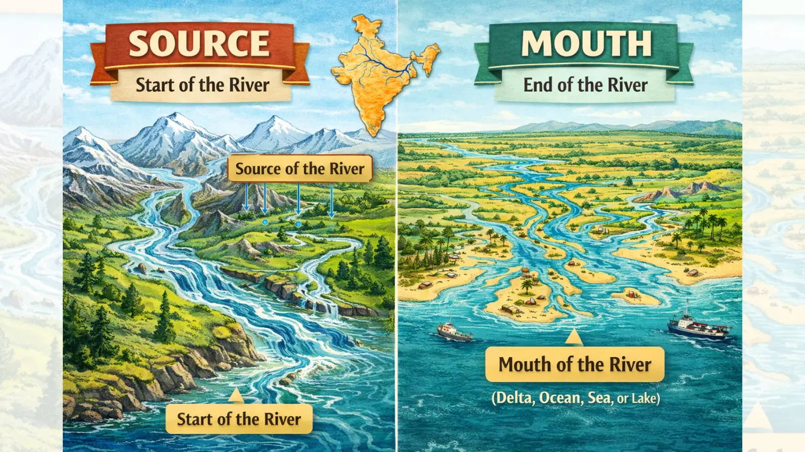
What is River Source?
Source of a River: The source of a river refers to the point or region from which the river originates and begins its course. It represents the initial stage of river development and is usually located in areas of high altitude, high precipitation, or permanent water availability. The nature of the source significantly influences the discharge regime, seasonality, and erosive capacity of the river.
In physical geography, the source is not always a single fixed point; rather, it may comprise a source region consisting of snowfields, glaciers, springs, or marshy uplands that collectively give rise to the river.
Types of River Sources
1. Glacial Source: Rivers originating from glaciers are known as glacier-fed rivers. These rivers are generally perennial due to continuous supply
from melting ice and snow. They exhibit high discharge during summer months and possess strong erosive power in their upper course.
Examples: Ganga (Gangotri Glacier), Indus, Brahmaputra.
2. Spring Source: Spring-fed rivers originate where groundwater naturally emerges at the surface due to geological structures such as faults, joints, or permeable rock layers. These rivers tend to have a relatively stable discharge.
3. Lake Source: In this type, rivers originate from natural lakes that act as storage reservoirs, regulating the river’s flow and reducing seasonal variability.
Example: River Nile from Lake Victoria.
4. Rain-fed Source: Rain-fed rivers originate in regions receiving heavy seasonal rainfall. Such rivers are typically seasonal or intermittent, with discharge closely linked to monsoon patterns.
Examples: Most Peninsular rivers such as Godavari, Krishna, and Cauvery.
5. Geomorphic Significance of the Source: The source region is characterised by steep gradients and dominant vertical erosion. Headward erosion in this zone may extend the river’s length and, in some cases, result in river capture.
What is River Mouth?
The mouth of a river is the terminal point where the river completes its course and discharges its water and sediment into a sea, ocean, lake, or inland basin. The mouth represents the final stage of the river’s geomorphic activity and is primarily a zone of deposition.
The nature of the river mouth is determined by the interaction between river energy and marine processes, such as tides, waves, and currents.
Types of River Mouths
1. Deltaic Mouth: A delta is formed when a river deposits a large quantity of sediments at its mouth due to a sudden reduction in velocity upon entering a standing body of water. The river divides into multiple distributaries, creating a triangular or fan-shaped landform.
Conditions favourable for delta formation include low tidal range, weak currents, and abundant sediment supply.
Examples: Ganga–Brahmaputra Delta, Nile Delta.
2. Estuarine Mouth: An estuary is a funnel-shaped river mouth formed where strong tidal action prevents the deposition of sediments. Here, the river’s load is carried away by marine processes.
Estuaries are typically deep, navigable, and economically significant.
Examples: Narmada, Tapi, Mahi, Periyar.
Geomorphic and Economic Significance of the Mouth
The mouth region is marked by extensive depositional landforms such as floodplains, levees, and deltas. These areas are among the most fertile and densely populated regions of the world.
Estuarine mouths, due to their depth and tidal influence, often develop into major ports and centres of trade.
Comparison of River Source & River Mouth
| Aspect | River Source | River Mouth |
|---|---|---|
| Location | High altitude / uplands | Sea level or basin |
| Gradient | Steep | Gentle |
| Dominant Process | Erosion | Deposition |
| Channel Nature | Narrow and deep | Wide and shallow |
| Landforms | Gorges, waterfalls | Deltas, estuaries |
Must Read Articles Associated with this Topic
This article is part of a series of articles that clear basic concepts of the drainage system and the river system. Students and aspirants are also advised to refer to the articles mentioned below.
- Drainage System & River System
- River Source & River Mouth
- Three Stages of River
- Three Processes of Rivers — Erosion, Transportation, and Deposition
- River Basin, Catchment Area, and Watershed
- River Tributaries & River Distributaries
- Drainage Patterns & Structural Control
- River Rejuvenation and Associated Fluvial Landforms
NCERT Geography Books and Other Sources
Students and aspirants are also advised to refer to the sources mentioned below.
- NCERT Geography Book of Class 9, Chapter 3: Drainage
- NCERT Geography Book of Class 11, Chapter 3: Drainage System
- Article on Major River System in India created by India- Water Resource Information System (WRIS) by Ministry of Jal Shakti